
Before You Break Ground: What Aerial Survey Reveals Beneath a Heritage Landscape
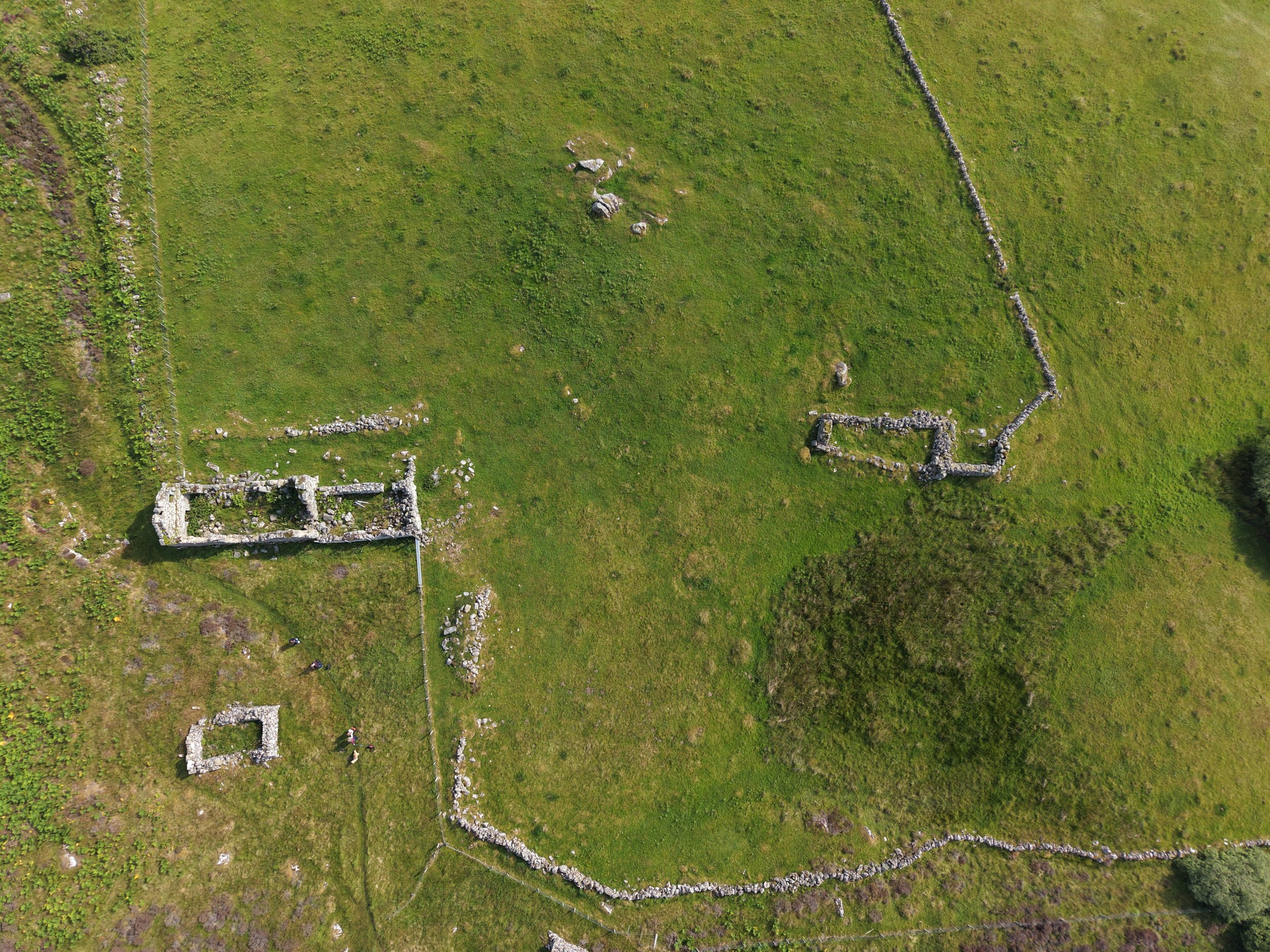
Aerial View showing a long since abandoned croft.
Historic ground rarely holds still. What the record says is there, what the eye can see on foot, and what is actually in the turf are three different things. On working estates and heritage sites that gap is not academic. It is the difference between planning a track, a drainage run or a new planting scheme with confidence, and putting a machine through something nobody knew was there.
A recent survey in Sutherland made the point better than I could have staged it.
What the record held
I was flying a cleared township, one of those quiet places where the shape of a vanished community still sits in the ground. It is already on record. A survey team walked it on foot in 1995 and did careful work: six roofless buildings, a two storey farmhouse with a byre outshot, a cartshed, what may have been a pig sty, each one measured. Reading the record before a flight, as I always do, tells you what to expect. Six buildings. A tidy account of a place that was.
The survey found something the account does not mention.
What the survey added
Offset from the buildings, on ground the foot survey clearly crossed, there is a ring. Roughly circular, about 28 metres across, low in the turf and easy to walk straight past. From head height it is almost nothing. From above, the whole circuit reads at once.
That gap is not a failing of the earlier work. It is the reason aerial survey earns its place. A surveyor on foot records what stands up: walls, buildings, anything with height and edges. A low, turf covered feature nearly thirty metres wide, set apart from the obvious structures, is exactly the kind of thing the eye cannot assemble from ground level. You only see a circle that size when you are looking down on all of it at once. Different vantage point, different information.
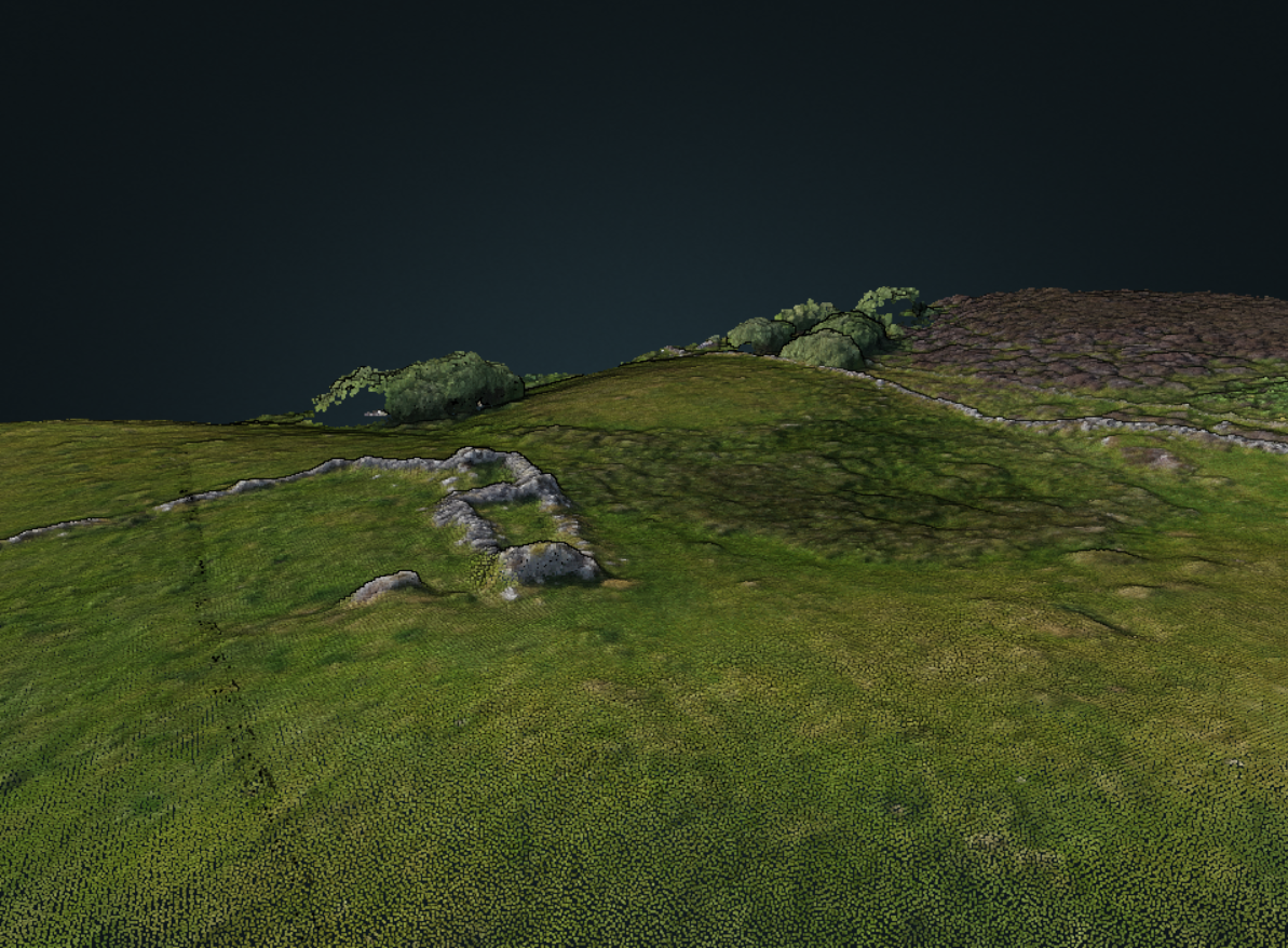
3d Mapping showing raised mound.
I will not pretend to say what it is. That is a question for the historic environment record, and I am reporting it there with its location, measurement and imagery so the right specialists can assess it. It sits within a landscape already recognised as holding activity across a very long span, and this feature is not among the components on file. An unrecorded thing, in known and valued ground. Worth logging, and not mine to interpret further.
What I can speak to is how the survey read it, because that is the part that matters for anyone managing land like this.
Reading it without a spade
You can learn a surprising amount about what is under the surface before anyone lifts a turf, and this is where the survey data earns its keep.
The vegetation index tells the first part. Stone near the surface stresses the grass above it. Shallow soil over rubble or a wall footing dries fastest, roots struggle, and in a dry spell that line shows up parched. Along this ring the vegetation does the opposite. It runs green, which argues against masonry or a wall footing sitting just below the surface. Green points to deeper soil and better moisture, the signature of an earthen or turf bank rather than stone.
The elevation model agrees. The ring reads as a low, uneven raised mound. Put the two datasets together and they describe the same thing: a slightly domed bank, drier across its crown, damper around its base. Two independent measurements, greenness and height, pointing at one feature. That agreement is what gives the reading weight.
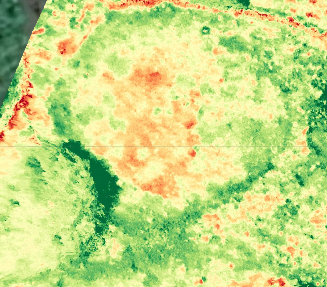
Image showing VARI of circle.
None of this is proof, and I would distrust anyone who claimed certainty from a single flight. A vegetation index off a standard camera is a coarse instrument, and one survey in one season is not a verdict. But the data leans clearly one way, away from masonry and towards an earthwork, and it did so before anyone touched the ground. That is the whole value of the method. It narrows the question and tells you where to be careful.
Why this matters before you break ground
This is not really a story about one feature in one glen. It is about what sits beneath historic ground everywhere, undocumented, invisible on foot, and entirely capable of being destroyed by routine estate work carried out in good faith.
An owner planning drainage, tree operations, a new access track or a change of use needs to know what is in the ground before committing a machine to it. A century of careful record can still leave a feature unaccounted for. Aerial survey and photogrammetry surface those things quickly and non-intrusively, and reading the vegetation and elevation data can often characterise them well enough to know whether you are looking at something that needs specialist input before work proceeds.
That is the service. Not digging, not dating, not guesswork, but seeing clearly what the ground holds so that decisions about historic landscapes are made with the full picture rather than half of it. On ground with this much depth to it, that is not a luxury. It is how you avoid being the person who put a track through something that had survived three thousand years until the morning nobody looked from above.